Note: If an image ever fails to appear - refresh your page, it really is there
Flags of the United States of America
Territorial Flags of the United States of America
- Those with flags, official or unofficial, in alphabetical order -
There is a rather complicated group of technical terms for United States territorial status that will be ignored here. If a territory (no matter what it's status) is governed and protected by the United States in any way, and has a flag, it has been added here. In many territories, only US military, government, and government contractor personnel live on a temporary basis, for examples: Johnston, Midway, and Wake Islands. Their population´s temporary territorial citizenship remains whatever it was when they arrived, mainly US, because there are no indigenous people on any of them to have nationalities of their own.
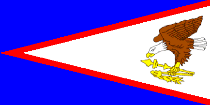
American Samoa Flag
|
Territory of American Samoa Flag
American Samoa is a territory of the United States located in the South Pacific, southeast of the sovereign State of Samoa (formerly known as Western Samoa). In 1889, the U.S. seized the smaller group of eastern islands, one of contained the harbor of Pago Pago, which they planned to use as a coaling station for United State Naval vessels. Intimdating the native ruler into signing over rights to the islands, the United States Navy then took control over them. Today, American Samoa is the southernmost territory of the United States.
The flag is blue with a white triangle, edged in red, based on the fly. The triangle extends to the hoist and bears the American eagle in proper colors and facing towards the hoist. It grasps the symbol of power of the Samoan chiefs, the "uatogi" (war-club), and the symbol of wisdom of the councils, the "fue" (ritual stick). The colors of the flag are both Samoan and American, and the American eagle, holding traditional Samoan emblems, represents the protection and friendship of the United States. |
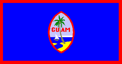
Guam Flag
|
Territory of Guam Flag 1960
Guam is the largest and southernmost of the Mariana Islands in the western Pacific Ocean. It is one of five U.S. territories with its own established civilian government. Discovered by Ferdinand Magellan in 1521, the first colony was established in 1668 and for the next two centuries Guam was an important stop for the Spanish Manila Galleons. The island was controlled by Spain until 1898, when it was surrendered to the United States during the Spanish-American War. Guam was captured by the Japanese in 1941, and suffered a harsh occupation for two and a half years. After fierce fighting, US troops recaptured the island in 1944, a date celebrated every year on the island as Liberation Day.
The Guam Flag was designed by Helen L. Paul, the wife of an American naval officer, and was officially adapted as the territorial flag by Governor Roy Smith in 1917. The background of the flag is a dark blue, which represents the ocean, accented by a red border. In the center of the flag is an oval figure in the shape of a slingstone used by the ancient Chamoru. The proa, a swift, seagoing canoe, typifies the craft the inhabitiants used, the coconut tree growing in barren sand depicts the determination of the early settlers to overcome their difficulties. The flag was officially adopted in 1948 and modified in 1960 when red border was added.
|
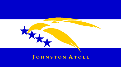
Johnston Atoll Flag
|
Johnston Atoll Flag 2001(Unofficial)
Johnston Atoll is a small atoll in the North Pacific Ocean about 860 miles west of Hawaii. The atoll consists of four islands located on a coral reef: Johnston Island, Sand Island, North Island (Akau) and East Island (Hikina). Johnston is grouped as one of the United States Minor Outlying Islands, administered by the United States Fish and Wildlife Service.
This unofficial flag of Johnston Atoll was used to represent the island in the December 7, 2001, Pearl Harbor ceremony. The official flag for all U.S. minor outlying islands is the U.S. flag. |
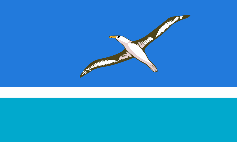
Midway Island Flag
|
Midway Island Flag 2001 (un-official)
Midway Island is an atoll in the North Pacific Ocean, near the northwestern end of the Hawaiian archipelago, about one-third of the way between Honolulu and Tokyo. Besides being the habitat for millions of seabirds, Midway is the former home of the Midway Naval Air Station. During World War II it was the location of the battle that was considered the turning point in the war in the Pacific. Midway was designated a National Wildlife Refuge in 1988, while still under the primary jurisdiction of the Navy. In 1996, President Bill Clinton signed the Executive Order which transferred the jurisdiction and control of the atoll to the U.S. Department of the Interior. The Fish and Wildlife Service assumed management of the Midway Atoll National Wildlife Refuge. The last contingent of Navy personnel left Midway in 1997 after an ambitious environmental cleanup program was completed.
This unofficial flag of Midway Island was used to represent the island in the December 7, 2001, Pearl Harbor ceremony. The official flag for all U.S. minor outlying islands is the U.S. flag, but this unofficial one is also used. |
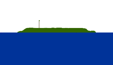
Navassa Island Flag
|
Navassa Island Flag 2001 (un-official)
Navassa Island is a small, uninhabited island in the Caribbean Sea administered by the U.S. Fish and Wildlife Service. Navassa Island was claimed for the United States in 1857 by American sea captain Peter Duncan who wanted its rich guano deposits. In the 19th Century the practice of "guano mining" for Guano phosphate to use as fertilizer for American agriculture was a very profitable business.
From 1903 to 1917, Navassa was a governed by the U.S. Guantanamo Bay Naval Base, and from 1917 to 1996 it was under United States Coast Guard administration and had a lighthouse built on it. Since 1996, it has been administered by U.S. Department of the Interior. Transient Haitian fishermen and others camp on the island, but otherwise the island is uninhabited. It has no ports or harbors, only offshore anchorages, and its only natural resource is guano; the only economic activity consists of subsistence fishing and commercial trawling activities.
The unofficial flag of Navassa Island was designed for and first flown at a World War II memorial tribute at the USS Arizona Memorial at Pearl Harbor, Hawaii on December 7, 2001. It is a white and blue horizontal bicolor, with a profile of the island (and its landmark lighthouse, with exaggerated size) in the white band. The official flag for all U.S. minor outlying islands is the U.S. flag, but this unofficial one is also used.
|
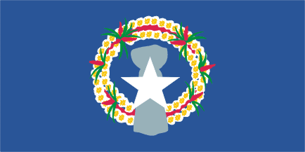
CNMI Flag 1981
|
Territory of the Northern Mariana Islands Flag 1981
The Northern Mariana Islands occupies a strategic region of the western Pacific Ocean. It consists of 15 islands about three-quarters of the way from Hawaii to the Philippines. More than 90% of the population lives on the island of Saipan.
In 1521, Ferdinand Magellan claimed the Mariana islands for Spain. Following the Spanish-American War of 1898, Spain ceded Guam and the Northern Mariana Islands to the United States and sold the remainder of the Marianas to Imperial Germany. During World War II, Japanese forces held Marianas, and in 1944, the United States military liberated the Mariana Islands. Since then the Territory of the Northern Mariana Islands have been the responsibility of the United States. When offered, the people of the Northern Mariana Islands decided in the 1970s not to seek independence, but instead stay with the United States. In 1975, a commonwealth in political union with the U.S. was approved, a new government and constitution went into effect in 1978.
The district adopted their flag in 1972; the territory adopted the same flag in 1976, and modified the design in 1981. |
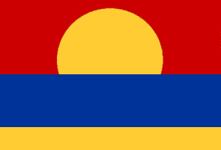
Palmyra Atoll Flag
|
Palmyra Atoll Flag 2001 (un-official)
Palmyra Atoll is an unoccupied equatorial Northern Pacific atoll administered as a US territory by the United States. The only population are essentially the staff and scientists employed by various departments of the US government and the Nature Conservancy, plus a rotating mixture scholars pursuing research in the Palmyra Atoll National Wildlife Refuge. Palmyra is grouped as one of the United States Minor Outlying Islands.
Palmyra was first sighted in 1798 by an American sea captain, Edmund Fanning of Stonington, Connecticut, while his ship the Betsy was in transit to Asia. On November 7, 1802 the first Western people landed when the United States ship Palmyra was wrecked on the atoll. In 1859, Palmyra was claimed by Dr. Gerrit P. Judd for the United States, under the Guano Islands Act of 1856; however, there was no guano to be mined. On February 26, 1862, King Kamehameha IV issued a commission to take possession of the atoll and on April 15, 1862, it was formally annexed to the Kingdom of Hawaii.
The unofficial flag of Navassa Island was designed for and first flown at a World War II memorial tribute at the USS Arizona Memorial at Pearl Harbor, Hawaii on December 7, 2001. The official flag for all U.S. minor outlying islands is the U.S. flag, but this unofficial one is also used.
|
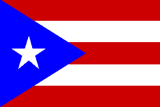
Puerto Rico Flag
|
Commonwealth of Puerto Rico 1952
Estado Libre Asociado de Puerto Rico
The Commonwealth of Puerto Rico is perhaps the best known territory of the United States, located in the northeastern Caribbean, east of the Dominican Republic and west of both the United States Virgin Islands and the British Virgin Islands. It became a US Territory after the Spanish-American War, in which Spain, under the terms of the Treaty of Paris of 1898, ceded the island to the United States. Although Puerto Ricans are U.S. citizens, the islanders may not vote in U.S. presidential elections. Since 1947, Puerto Ricans have been able to elect their own governor. The island's current political status, including the possibility of statehood or independence, is widely debated in Puerto Rico.
The flag was created in 1895, by the Puerto Rican section of the Cuban Revolutionary Party, advocated independence for Puerto Rico and Cuba from Spanish rule. It has five horizontal stripes, alternating red and white, with a white star on a triangular blue canton. Strangely enough, Puerto Rican police would arrest anyone displaying the flag on charges of insubordination against the United States before 1952, but after Puerto Rico became a Commonwealth the same flag became the island's official flag. |
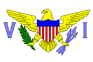
Virigin Islands Flag
|
Territory of the Virigin Islands Flag 1921
The Virgin Islands of the United States (or United States Virgin Islands) is a United States territory located in the Caribbean. The group of islands are geographically part of the Virgin Islands archipelago and consists of four main islands: Saint Croix, Saint John, Saint Thomas, and the smaller Water Island, and many other surrounding minor islands. Tourism is the primary economic activity. Formerly known as the Danish West Indies, they were sold to the United States by Denmark in the Treaty of the Danish West Indies of 1916.
The flag of the Virgin Islands uses a simplified version of the Great Seal of the United States between the letters V and I (for Virgin Islands). The concept of a U.S. Virgin Islands Flag was that of Rear Admiral Summer Ely Whitmore Kitelle, the Territorial Governor of the Islands in 1921. He asked for suggestions for a flag design. The one chosen was a bird holding a laurel branch in one talon, and three arrows in the other, representing the three major islands. The bird is either an eagle or a Bananaquit depending on who you ask.
|
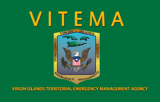
VITEMA Flag
|
Virgin Islands Territorial Emergency Management Agency 2011
The Virgin Islands Territorial Emergency Management Agency is in charge of the islands primary response to, and care for those impacted by both natural and man-made disasters, and the following recovery from those disasters. The Agency is also in charge of the islands homeland security, its 911 emergency operations and emergency preparedness and response.
The official flag of the Virgin Islands Territorial Emergency Management Agency was adopted in September 2011. It consists of a simplified, combined version of the Great Seal of the United States Virgin Islands between the letters V and I and the seal of the VITEMA used since 1981.
|
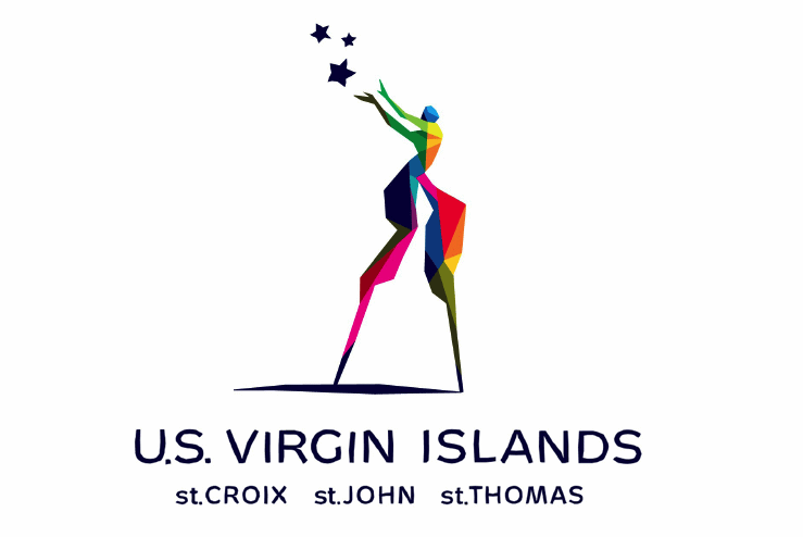
Virgin Islands Tourism Flag
|
The Virgin Islands Tourism Flag 2009 (un-official)
The Department of Tourism of the U.S. Virgin Islands launched a new un-official Virgin Islands flag as part of a new campaign to attract tourism early in 2009. Since then the flag has enjoyed some popularity and been seen displayed on many parts of the three main islands. The flag was designed by J. Walter Thompson and features a Mocko Jumbie (a type of traditional stilt dancer) as its main icon.
According to the then Virgin Islands Commissioner of Tourism, Beverly Nicholson-Doty, "The Mocko Jumbie character symbolizes the vibrancy of our people and our culture, while the stars represent the enchanting and individual spirits of St. Croix, St. Thomas and St. John."
|
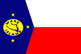
Wake Island Flag
|
Wake Island Flag 2001 (un-official)
Wake Island is a small coral atoll in the North Pacific Ocean. Since 1899, it has been a territory of the United States, administered by the U.S. Department of the Interior. Access to the island is restricted, and all activities on the island are managed by the United States Air Force which maintains a runway there. There are no indigenous inhabitants and only United States military personnel live on the island. The island remains a strategic location in the North Pacific Ocean and serves as an emergency landing location for commercial transpacific flights. On January 6, 2009, President George W. Bush included the atoll as a part of the Pacific Remote Islands Marine National Monument.
This unofficial flag of Wake Island was used to represent the island in the December 7, 2001, Pearl Harbor ceremony. The official flag for all U.S. minor outlying islands is the U.S. flag, but this unofficial one is also used.
|
Sources: Much of the text on this page was modified from text on the "Flags of the World" website and from "Wikipedia."
|